Llowes Settlement to 1750 Clwyd Powys Archaeological Trust Historic Settlements Survey - Radnorshire |
|
Llowes
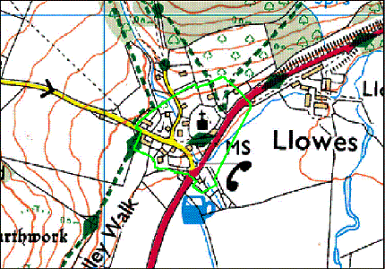
SO 192417 Introduction
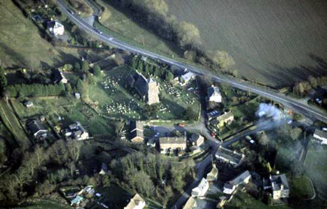
Set on the west side of the Wye just above the valley floor, Llowes
church and the village that surrounds it occupy a spur between
the main valley and a dingle formed by a small tributary that
runs off the lower slopes of The Begwms to the north-west. Below
the churchyard the stream loops around and takes a north-easterly
route to the Wye providing a low promontory on which the church
was established. The village has grown up on both banks of the
stream and is now expanding up the hill behind the church. |
|
|
|
|
|
History of development St Meilig is said to have come from Clydeside in c.AD 650 and he or his successors are believed to have established a clas community at Llowes. Whilst the church is fficially dedicated to St Meilig, the name of the settlement reflects an obscure holy man St Llywes (Lyuhes) who was supposedly already established here when he was joined by Meilig. This in turn appears to be linked to old Welsh loches/llochwes meaning ‘ a refuge or place of safety’. It is mentioned both in the Liber Landavensis and by Geraldus Cambrensis. The former has it as podum liuhess in eluail with a date broadly in the second quarter of the 12th century, and Geraldus referred to it as Locheis. In the papal taxation of 1291 it was named as both Lewas and Lockwas. There is a reference, unsubstantiated, to the fact that an anchorite named Wechelen had a hermitage here in the 12th century (4347). The nature of the subsequent development of the settlement can only be guessed at. In a survey of 1816, it consisted of a church, public house, mill and nine dwellings. Unlike some settlements there is no suggestive patterning, and the only archaeological work in the village – a watching brief in 2000 – failed to identify any medieval or later traces of activity next to Mill Cottages. The Heritage to 1750 |